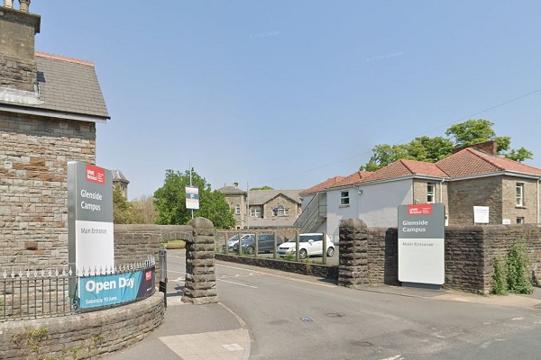
UP to 300 homes could be built at Fishponds’ Glenside campus after the University of the West of England leaves.
The figure was revealed in Bristol City Council’s new draft Local Plan for the city, a planning blueprint for nearly 35,000 new homes.
The former Glenside Hospital site on Blackberry Hill is the most significant new addition to the list of places the council believes could be redeveloped between now and 2040.
The Voice revealed in September that UWE was relocating its School of Health and Social Wellbeing from the Grade II-listed 19th century buildings and grounds to a new purpose-built facility on its Frenchay campus.
The majority of the areas earmarked for new homes in the Local Plan are in areas the council has already included in “development strategies” or “growth and regeneration” plans.
The blueprint document contains more than a dozen policies giving an overall approach to development in each of these.
Most significant in the Fishponds area is the Central Fishponds Development Strategy Area, which includes the three sites between the Bristol & Bath Railway Path, Lodge Causeway and Forest Road that developers have named Atlas Place.
The Central Fishponds DSA also includes Morrisons, Channons Hill retail park and an area either side of Fishponds Road between Brentry Road and Channons Hill.
The plan document says: “A decline in the need for some local industrial and warehousing land has presented a significant opportunity for the development of new homes in and around the town centre.
“Underused sites around Fishponds Road at the western end of the town centre present further opportunities.”
However the total number of new homes listed for the area in the blueprint is 1,500 – only 345 more than have already been proposed for two of the three Atlas Place sites by Graphic Packaging International and Central Fishponds Ltd.
The third developer, Castel Ltd, has yet to publish any plans.
The Local Plan document describes Glenside as a 6.8 hectare (around 17 acres) with an estimated capacity of 300 homes, that is “no longer required for education related provision” and suitable for “housing with mixed-uses”.
It is listed in the local plan’s 261-page appendix of other sites where the council has allocated land for potential homes.
Cricket club, paddock and garage sites also on development list
Others in the Frome Vale, Eastville and Hillfields council wards that make up the Fishponds area include Stapleton Cricket Club, which is listed as having a capacity for 50 homes and appeared in the council’s previous revision of the Local Plan in 2019, sparking a campaign from residents.
The council says the land “would only be considered appropriate for development subject to identifying an alternative playing pitch for recreational uses”.
A small field off College Road used as a paddock has also appeared on the list again as a site for “self-build, custom housebuilding or community-led housing”, four years after its inclusion in the previous review led to a residents’ campaign to protect the site.
The list also includes:
*The Berkeley Road Garage site on the corner of Berkeley Road and Lodge causeway, described as suitable for 17 homes “if no longer required in its current use”.
*A garage site at Woodland Way (10 homes)
*Land next to Bristol West Indian Phoenix Cricket Club, Clay Hill (50 homes).
*Hendys Yard, Lower Grove Road (10 homes, “if no longer required in its current use”).
*Rose Green Reclamation, Rose Green Road (10 homes, “if no longer required in its current use”).
*Former SSA Wholesale Cash & Carry, Stapleton Road (18 homes).
More details can be found on the Local Plan Review page of the city council’s website.
Figures from Local Democracy Reporting Service


